Issue
The New Jersey Department of Environmental Protection (DEP) has been mapping the state’s land cover and impervious surface levels for decades. These datasets help the agency assess, monitor, and proactively respond to landscape changes to better manage and protect natural resources and the environment.
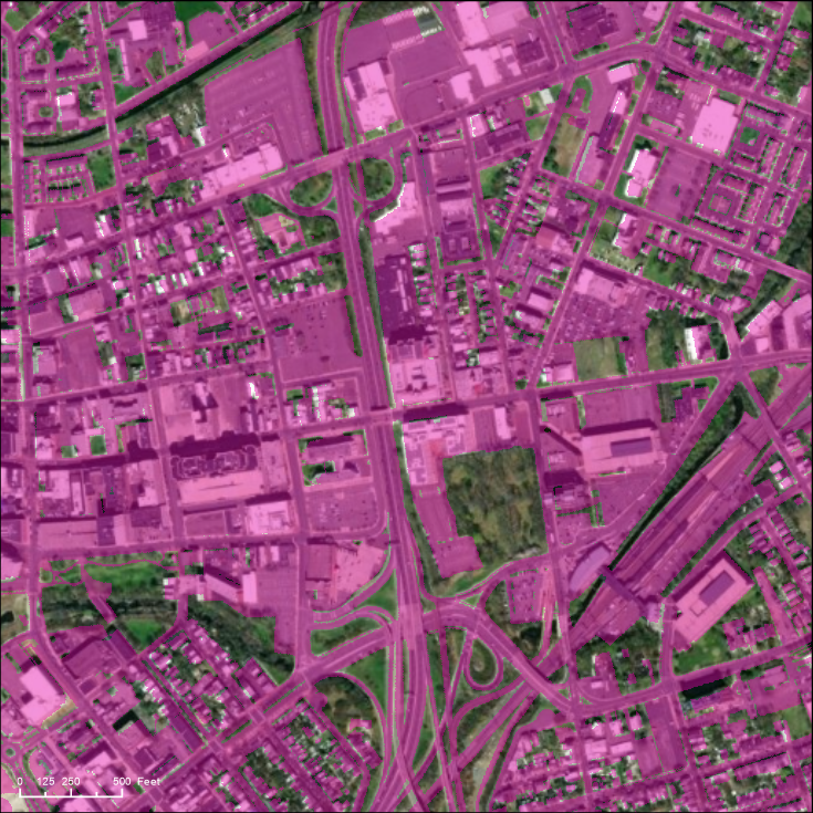
Understanding the amount of impervious surface (such as the concrete and asphalt that comprise roadways, parking areas, sidewalks, and buildings) is critical for preventing flooding, water quality issues, and urban heat island effects. For the 2020 data update, insufficient funding meant the agency could only map land use/land cover, creating a gap in the impervious surface data.
Process
As the New Jersey Department of Environmental Protection was completing the land use/land cover mapping, NOAA’s Coastal Change Analysis Program (C-CAP) was beginning a nationwide high-resolution mapping initiative. C-CAP creates standardized, raster-based inventories of land cover for the coastal U.S. derived from remotely sensed imagery. From this inventory, the C-CAP team was able to provide an impervious surface layer for the entire state of New Jersey. While the NOAA data was not produced in the same way as the state’s data, it delivered more up-to-date mapping information that helped the agency evaluate the impervious surface levels of land that had changed from non-urban to urban in the previous five years.
Impact
A complete picture of impervious surface is crucial for informing policies that mitigate flooding, water quality, and urban heat islands. With the C-CAP data, the New Jersey Department of Environmental Protection now has comparable data the state can rely on for understanding change in impervious surface levels, despite the funding lapse. This information rounds out the larger land use/land cover dataset that supports the state’s efforts to monitor ecosystem and human health. (2025)